| Trigger | Natural | Avalanche Type | Soft Slab |
| Aspect | North | Elevation | 2700ft |
| Slope Angle | unknown | Crown Depth | unknown |
| Width | unknown | Vertical Run | unknown |
Avalanche: Douglas Island
Location: Fish Creek Valley
Up and down showboat via Hooter
Avalanche Details
Touring up Showboat today, we noticed a natural avalanche that appeared to have run overnight in Fruit Bowl. It was in the shade, but it looks like a new windslab triggered off of the ridge and ran down the whole bowl to a large bench. Could not see the crown, but the debris tongue was impressive for the feature. Looked like some of the new snow was on the debris. We assumed that it failed within the recent storm snow or on the old/new snow interface.
Obvious signs of instability
| Recent Avalanches? | Yes |
| Collapsing (Whumphing)? | No |
| Cracking (Shooting cracks)? | No |
Observer Comments
20-30cms of new snow from last night is sitting on another 10-15cm of recent storm snow, all sitting above a thick ice layer from the mid-January thaw. New snow is drifted and redistributed by the wind above 1700ft. Hand shears show moderate to easy planar shears within the previous storm snow above the ice. No cracking in the limited amount of steep ridgetop terrain I saw but I'm sure you could find some.
Weather
Broken skies and light winds at 8:30 am gave way to full overcast, snow, and more light winds by late morning.
Snow surface
POW! Wind redistributed storm snow, soft and great, but a little "upside-down" in places.
Snowpack
Upper snowpack at 2600ft SW aspect: 20-30 cm of 1 finger slab sits above a 10-15cm layer of slightly less dense recent storm snow, all on top of an ice layer. In some places the ice surface is smooth, and in others, it is very rough from roller balls and debris rolling off of trees and steep terrain above. Snow is soft and lovely to ridgetop, but was redistributed by the wind above 1700ft.
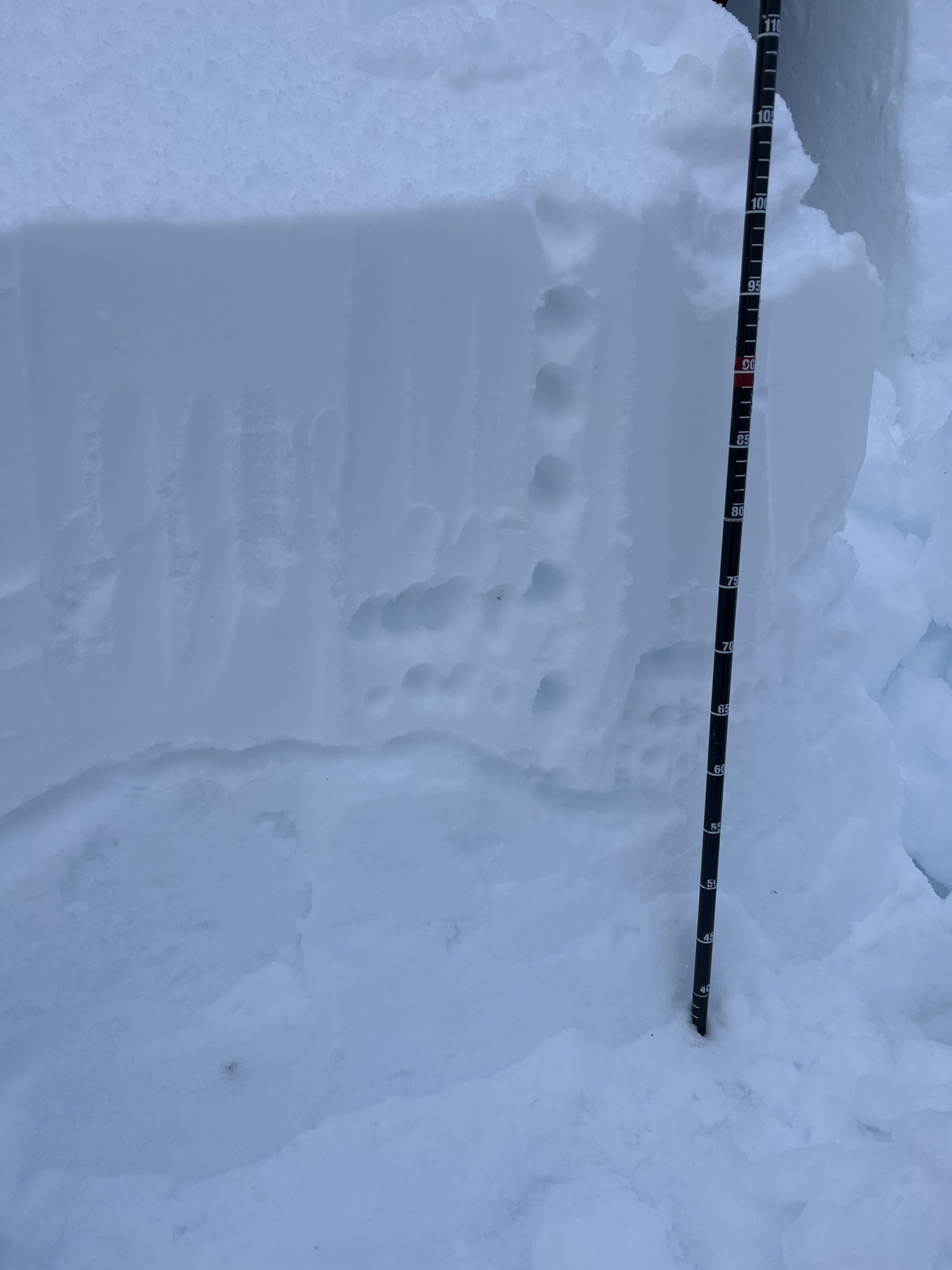
Surface snowpack at 2600ft, SW facing steep slope. About 40cm of snow on top of the mid January crust. Snow depth here was about 3m but variable.
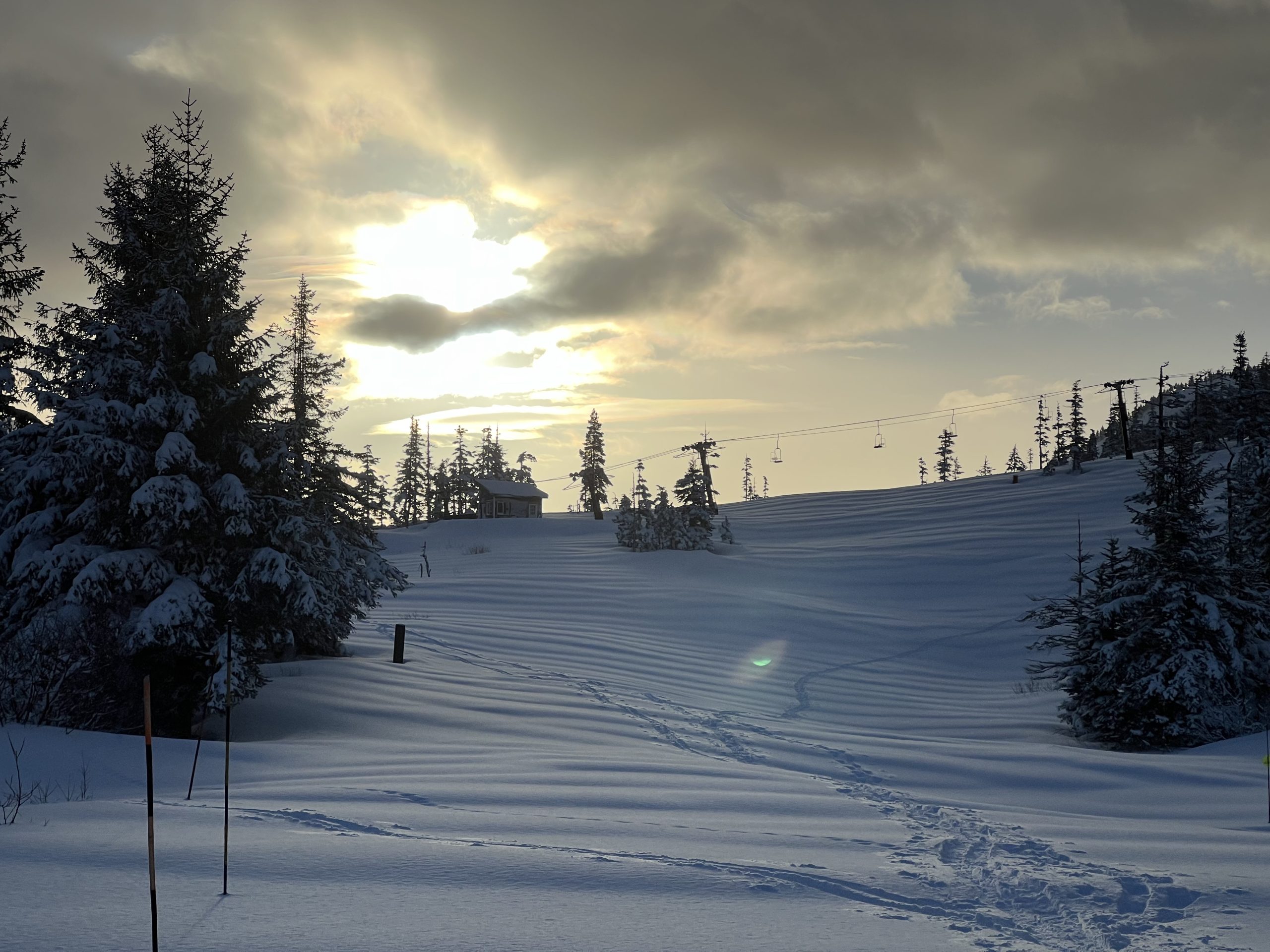
Wind texture at the top of Hooter.

Fruit Bowl, High East Eaglecrest
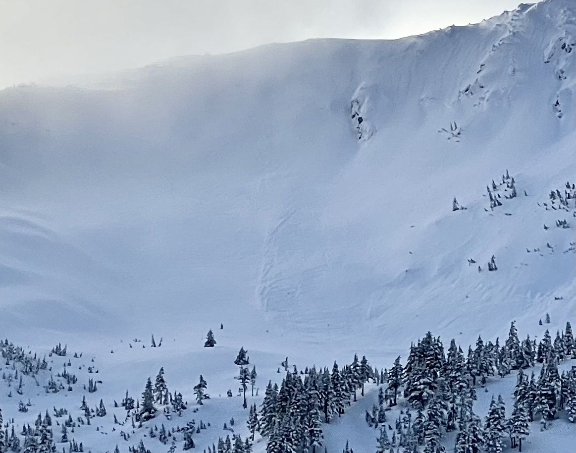
Zoomed in and contrast cranked of Fruit Bowl, suspected wind slab